Saturday, November 28, 2009

Sunday September 13th - Down

It was a cold morning and my bladder woke me at precisely 6am as it had got into the habit of doing. After taking care of that, I snuggled back into the warmth of the sleeping bag and took my time over getting up properly. I left at 9, picked up a pretzel and some rolls at the bakery and continued to climb further into the Black Forest.

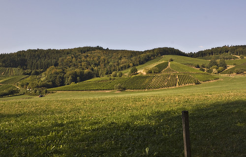
I stopped to eat the pretzel at a pretty spot overlooking a valley.
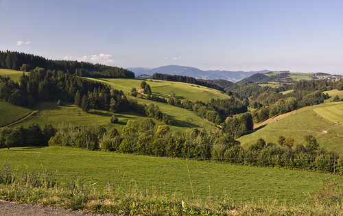
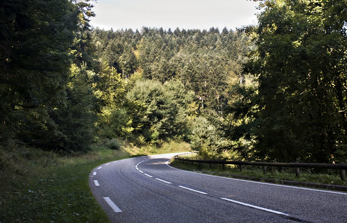
Schwarzwald

Close to the top of the hill I was diverted onto a cycle route leading away from the road and towards Titisee-Neustadt. The route kept me going for most of the way and all the way to Bonndorf - there were some ups, some downs and some gravelly bits.

The section from Neustadt to Bonndorf ran alongside a disused railway line. At Lenskirch it crossed a valley, doubling back on itself. I stopped in the town for lunch at an Italian restaurant - I had some delicious pasta stuffed with artichoke, and a hot chocolate (since it had been a while...)

After Bonndorf the previously excellent cycle route signage was reduced somewhat. Rain had threatened earlier but never happened, but now I kept singing rain songs. "Oh now I wish it would rain down" (and trust me I am not a Phil Collins fan), "Raindrops keep falling on my head" and of course "I'm only happy when it rains" (which is definitely not true). I struggled to think of any sun songs.
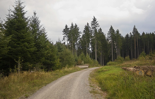
Cycle path


The descent started at Bonndorf. Unfortunately my front derailleur wasn't behaving - it refused to shift properly and kept springing back to the smallest chainring. Which was an annoying problem to have on what should have been a fun and fast downhill, but I'd rather that than be stuck on a large chainring on the way up!

I saw a motorcycle crash on the way down. The guy was coming the other way and skidded on the corner, the bike sliding sideways and lodging under the crash barrier. He got up straight away and dusted himself down, insisting he was OK. His two friends stopped to help and there wasn't much I could do other than gawp and struggle to string a German sentence together, so I went on my way.

I camped near the small town of Untermettingen. Upon examining the dodgy derailleur, the problem turned out to be quite simple - a loose gear lever.

Distance: 42 miles (570 miles so far) • Day 13 Route • Day 13 Photos

Saturday September 12th - Schwarzwald

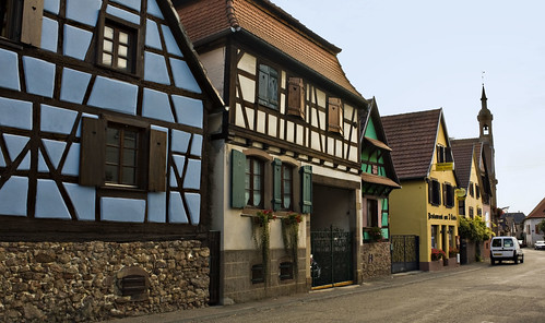
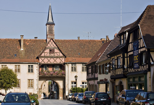
I started out from Obernai the next morning and rode through pretty towns filled with brightly coloured half timbered houses covered in flowers.

Half timbered

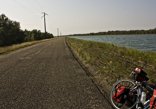
I found a well signposted cycle route alongside the Rhone-Rhine canal which led me towards the Rhine river, past a hydro electric power station and into a nature reserve on a narrow island in the middle of the river. There was nobody else on the path, which was closed to motor traffic - just me, the river and the sunshine.

Rhine

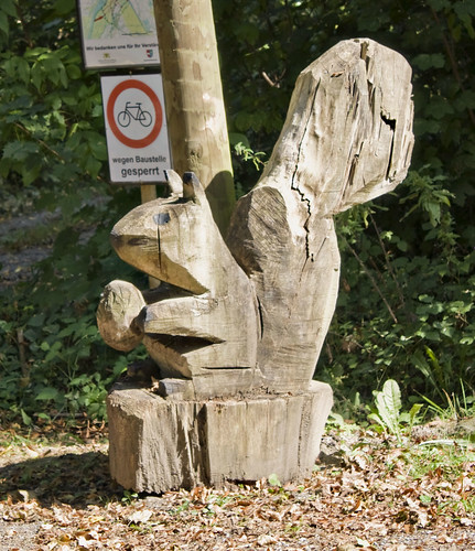
I emerged into Germany and followed signs to the small town of Weisweil. Wooden statues and carvings lined the road - squirrels, rabbits, apples...

Squirrel

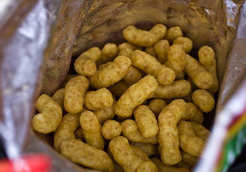
I'd been making excellent progress that morning but hadn't found lunch yet and was getting hungry. I tried to find somewhere to eat in Kenzingen but everywhere seemed closed or deserted. Lidl saved the day and I picked up some German camembert, more kiwis, a yoghurt and a bag of crisps. I found a picnic spot just outside Emmendingen and discovered that the crisps tasted exactly like peanut butter.

Erdnuss Flips

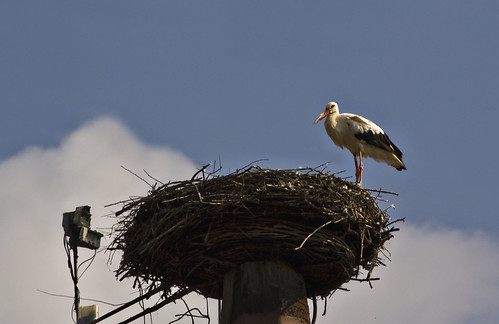
More canals led me to Denzingen where the town stork was nesting on the church roof.

Storko

The Black Forest was close now. The cycle route signage had been excellent all day but I was expecting it to disappear as soon as the serious hills started. It didn't seem like it'd be worth anybody's while to provide dedicated cycle facilities in the mountains. Surely not enough people would want to ride there? It turned out I was quite wrong.

I left Denzingen and continued to follow the signs (or so I thought) along the road and onto some narrow paths. The paths started to twist quite steeply up the hill. I saw no more cycle route signs. Pedestrians and horse riders passed me, but no cyclists. I arrived at a junction, giving me the choice between a sandy stony track going straight on or a more paved route twisting around to the left. I stopped, unable to figure out where I was until I flagged down a car and asked in my best shaky German whether I was going the right way for Glottertal. The driver seemed to say yes so I carried on up the track. It got steeper and I got off to push until I reached a lookout overlooking the fields below. A mountain biker had stopped there for a rest and offered routing advice when he noticed my bike. Apparently the path I was on was about to turn into technical single track. I'd taken a wrong turn, something my instinct had been trying to tell me for the last twenty minutes. He pointed out the road below and once I got back down the hill I picked up the cycle route again easily and reached Glottertal.

Black Forest

Now I started to worry about accommodation - it was Saturday again. There was a campsite further up (in the vertical sense) but I felt happy to stop in Glottertal and get a room. I found a pension with a "zimmer frei" but they only had a triple room - the owner tried calling around some other places but all were full. So I carried on to the campsite, which was 10km away but about 400m up. The cycle route signs warned of a 6% gradient - certainly nothing I can't handle.

And so I found a good rhythm and kept pedaling. The sun was on its way down, casting long light onto the hills. I grinned at cyclists flying past in the opposite direction - envious but wanting to share in their sheer joy.

I reached the campsite before sunset and ate at the campsite restaurant which was fantastic. Noodle soup and salad, followed by a mushroom pancake which was literally just a pile of mushrooms upon a folded pancake but the mushrooms were so well cooked and full of flavour. I could have quite happily ordered a black forest gateau for dessert (in fact I'd been thinking about it all day) but the waitress misunderstood my gesturing and brought me the bill instead of the dessert menu :-(

Distance: 60 miles (528 miles so far) • Day 12 Route • Day 12 Photos

Thursday, November 26, 2009

Thursday September 11th - Strasbourg

I left my bike locked up in Obernai and caught the bus into Strasbourg at dawn.

I'd asked for two nights at the campsite to give me the opportunity to take a day off cycling and spend some time seeing what I considered to be one of the highlights of the trip. And so, hoping to get some nice early morning light in the city, I left the tent when it was still dark and crept away to the bus stop.

We arrived just after dawn - unfortunately my early light plans didn't work out as it turned into an very cloudy morning.

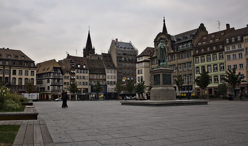
I bought a pain au chocolat and sat down in Place Kleber, watching a family of cute baby sparrows playing in one of the flower beds.

Place Kleber

I was still hungry after that so bought a pretzel. I'd never had a real pretzel before (i.e. bread, not the little snacky cracker things) and this was the beginning of a beautiful new relationship between me and my twisty salt-encrusted doughy little friends.

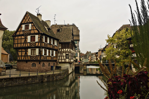
After a little wandering, I found the best bit - well, one of them anyway, the picturesque Petit France quarter consisting of stunning half timbered buildings overlooking the river.

Petit France

I bought some oil for the bike and spent an hour at an internet cafe, investigating train routes home and possible paths across the Black Forest.

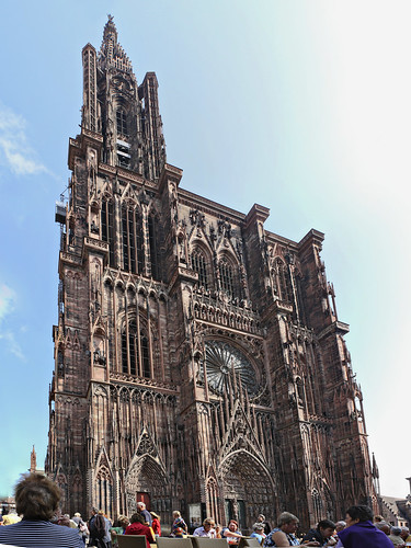
After that I located the cathedral, an incredibly ornate building.

Strasbourg Cathedral

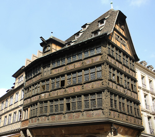
And beside it, the almost impossibly beautiful Maison Kammerzell.

Maison Kammerzell

Strasbourg is a popular cycling city and has plenty of lanes and parking facilities - my feet were sore from walking by the end of the day and I half wished I'd brought my bike into town, but it did make a nice change to have a day out of the saddle.

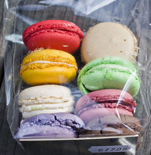
I picked up some horrendously coloured but very tasty macaroons from one of the many delicious looking patisseries...

Macaroons

... and then headed back to the campsite.

Back at the tent, I started to pay some attention to my bike. It had started squeaking over the last couple of days so clearly needed an oil... but upon examining the rear sprockets I realised how gunked up it really was. I spent a good couple of hours that evening scraping solid rubbery black gunk off the sprockets, chain and derailleurs and really wishing I'd bothered to clean it before leaving. The other thing I noticed was just how knackered the tyres were. The front was full of holes and the tread on the rear was almost non-existent. The last time I'd changed them was over three years ago, in Germany. I calculated that I'd ridden in eleven countries on those tyres, over unknown thousands of miles. I picked small stones out of the holes and planned to replace them when I got home.

Sunday, November 22, 2009

Wednesday September 10th - Vosges

I started out late from the campsite at Phalsbourg and headed straight for the town to do what I should have done over the last couple of days and buy some decent food from the shops - fruit, cheese, salads and bread. (yeah, more bread. It's hard to get away from in France)

I had been studying the map and come up with a nice wiggly green (i.e. scenic) route along a foresty road through the Vosges mountains, via Dabo.

Vosges

The road was flat at first then started to gently climb, with signs towards the Plan Incline. This is one of those things I didn't really understand at the time but now that I've got back and done a bit of reading, sounds quite interesting and makes me wish I'd stopped off to take a closer look. The Saint-Louis-Arzviller Inclined Plane is a clever lifting mechanism for getting ships up the mountain canal route as a quicker alternative to multiple locks.

After a long hot climb, I reached the town of Dabo. The sun was high in the sky and it was getting a little hot for comfort so I stopped in the shady town square, placing the solar panel in a patch of sun - despite all the sunshine, it still wasn't gathering enough energy to keep my phone going. A group of Canadian cyclists on lovely lightweight racing bikes stopped to say hello - they were staying nearby and enjoying the sunshine on the last day of their holiday.

Dabo

Further climbing out of Dabo led me up the Col de Valsberg to La Hoube then over the departement border and onto a lovely long descent down into Alsace. At Romanswiller I picked up a cycle path which ran along a disused railway line and a canal.

Canalside

I passed several other cyclists and walkers, and the signposting was quite good until I reached Molsheim and it disappeared. Motorways and major roads met just south of Molsheim and I couldn't pick out a good route on the map to get past all that. A local cyclist stopped to offer help and invited me to follow him through a maze of back streets, eventually leading to a bridge over the motorway and back out into the countryside. I thanked him and he left me on tiny lanes among cornfields, the cycle route to Obernai now clearly signposted. I gathered some speed and then, not really looking where I was going, hit a rather steep speed bump at 20mph, jarring my arms quite badly - which hurt, but no real damage.

I lost the cycle route briefly in the pretty town of Rosheim but the tourist office put me back on track.

Rosheim

After that the road surface got very bad at Bischoffsheim but I finally reached Obernai, where the campsite was very well signposted and thankfully selling cold drinks and ice lollies (something that had become more appealing over the last few days than lunchtime hot chocolates). More importantly, a Chinese restaurant was just down the road and I was able to tuck into hot, greasy delicious chicken chow mein for dinner. Yum...

Distance: 45 miles (468 miles so far) • Day 10 Route • Day 10 Photos

Saturday, November 14, 2009

Tuesday September 9th - No lemonade

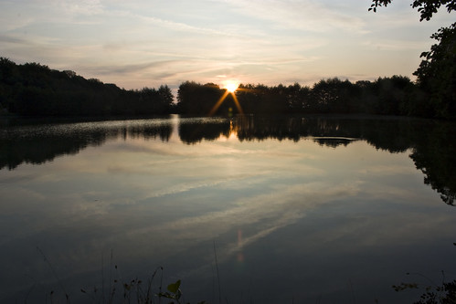
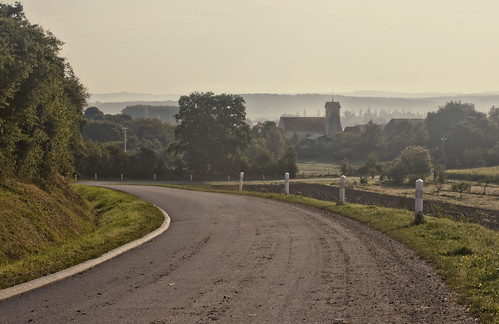
The tent was even wetter than usual when I woke up at Burtoncourt. I walked down to the lake to take some photos of the sunrise and then spent a long time trying to dry out the tent and not making a very good job of it.

IMG_5453.JPG

I'd been really bad at eating properly over the last couple of days - there had been fewer cafes so boulangeries had provided both lunch and dinner, and I was getting a little bit fed up with bread. Today was no better. It was a long day - I set my sights on a distant town with a campsite and went for it, choosing to put in the miles rather than divert into a town and seek out some decent lunch.

IMG_5463.JPG

I cycled across misty farmland and through the towns of Boulay Moselle and Boucheporn. At Longeville I bought a baguette and a small quiche, then got on the N-road to St Avold, for want of a better route.

One of the things they don't tell you about cycle touring (and this probably also applies to backpacking and other such forms of travel) is the crap music that gets stuck in your head. I attribute this to two things - firstly, the terrible music they play in cafes and other public places, and secondly the lack of my own source of music to wipe away the bad stuff. After nine days on the road, my head was mostly full of Lily Allen singing "It's not fair, it's really not ok, it's really not ok" over and over and over and it was very, very annoying. I figured I had to get something decent but catchy into my head so started to hum catchy but enjoyable classics such as 99 Red Balloons and The Final Countdown.

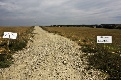
Beyond St Avold stood a handwritten sign pointing to Biding, which was a village I was hoping to pass through. The sign pointed down a slightly stony track, so I set off on another off road jaunt along bumpy ground between fields. I reached Biding after a couple of miles, unconvinced that that had been the road marked on the map but having enjoyed it nonetheless.

IMG_5475.JPG

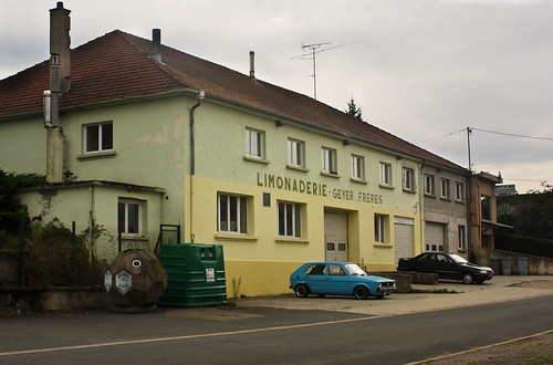
Further down the road, signs pointed me to Munster which boasted of both its church and limonaderie. I'm not really fussed for churches but it had turned into a hot day and I was soon daydreaming about cool lemony drinks. I arrived at Munster hot and thirsty and ready to drink a gallon of the stuff. I found the limonaderie but nowhere to buy the lemonade, and left as thirsty as I'd arrived.

IMG_5487.JPG

I arrived in Phalsbourg late in the day and followed signs through the town to a campsite on the outskirts. I was greeted by friendly English-speaking owners and directed to a mostly empty camping field. Too tired to ride into the town and find proper food, and too lazy even to cook up the emergency spaghetti, I dug into my panniers and had bread and butter for dinner again...

Distance: 62 miles (423 miles so far) • Day 9 Route • Day 9 Photos