Thursday, October 29, 2009

Saturday September 6th - Luxembourg

I awoke to hotel breakfast at 7am, which was a huge and very tasty feast of pastries, breads, jams, yoghurt, two poached eggs, assorted charcuterie, orange juice and tea. I left absolutely stuffed.

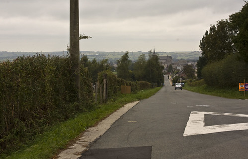
I headed out of Malmedy towards St Vith and it quickly became clear it was one of those days. The ones where it feels like you're carrying an extra bag of rocks but you can't figure out why. (although looking back, it may have been breakfast related). It also happened to be uphill, not an easy start to the day.

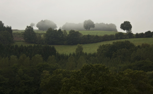
It was a cold misty one - well, more like a cold white cloud blanket. It almost felt like the kind of cloud that gives way to snow (but not cold enough). I held out hope that it was one of those mists where the sun breaks through and it all goes away but it took two hours for that to happen, it didn't last long and the air remained cold.

Misty morning

I arrived at St Vith and realised I was into German speaking territory. But that's OK - I can just about cope with simple German.

I stopped at a bakery, pointed at a tasty looking chocolatey pastry thing and asked what it was. She replied to the effect that it was some kind of chocolatey pastry thing. Yum. I asked for one, but somehow she took that to mean I wanted six and started to fill a large paper bag with pastry after delicious pastry. I attempted to correct the mistake "Nein, nein, ich mochte EIN, nicht sechs" (or something like that) but she took 'one' to mean 'one more' and I ended up with seven. Again I tried to ask for just one but ended up with yet another. I had eight chocolate pastries, and my German wasn't good enough to explain the error. Fortunately another customer saw the problem, explained to the assistant and I left with my single pastry.

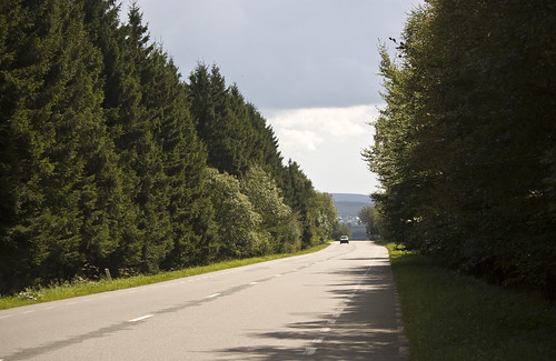
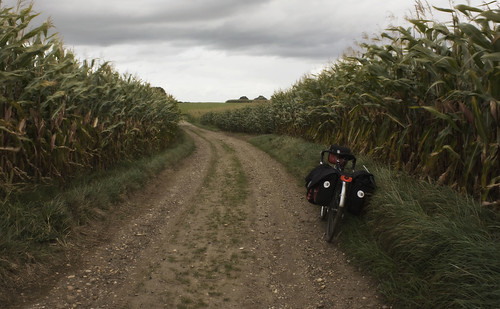
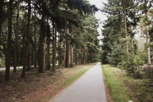
After St Vith the N-road I was following got a lot busier and there was no cycle path. I took the turn off to Thommen and a pleasant detour via Burg-Reuland and the Ouren valley.

Stripy forest

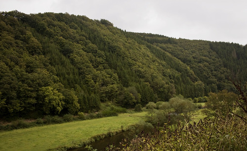
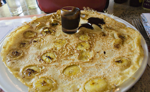
The valley delayed my entry into Luxembourg ever so slightly but it was worth it for the quiet roads, lush forests and pancake house, and since I have developed a strict policy of never looking a pancake house in the mouth, it was compulsory to stop. I ate my sugar & butter pancake in Belgium with Germany just across the Our river to my left and Luxembourg about a kilometre to the right.

I started a long hard climb out of the valley towards the border. It was only a single gradient arrow on my Michelin map, which is normally fine, (4-7%) but it seemed a lot steeper than that. A pack of roadies passed me on the way up and I wondered whether, to an outside observer, it looked as if i was with them and carrying all their stuff! I had to stop several times and, although they were lighter and faster, I could see it was tough on them too. Apart from maybe the guy who turned around at the top of the hill, rode back down and overtook me for a second time.

At the top I passed an EU flag by a church- that may have been the border but it wasn't clear.

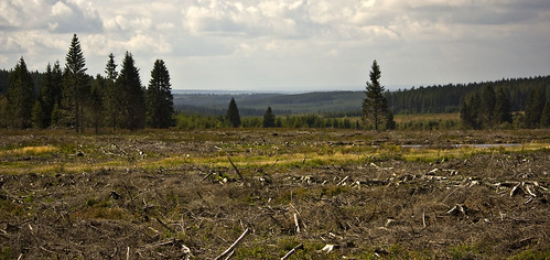
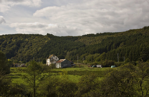
I carried on towards Clervaux. The landscape seemed quite English in many ways - hilly with grassy fields, cows grazing, some arable land with rolls of hay, dots of forest here and there, but a lot more wind turbines.

Lux

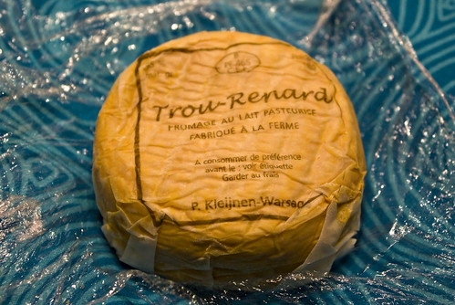
Doubts about the trip re-entered my mind at Clervaux, mostly due to being both cold and frustrated with my own lack of fitness. Clervaux had a railway station which I considered using, but decided I wasn't prepared to give up just yet. My third-day blues had extended well beyond the third day but I was determined to shake them off and give it at least a week. I carried on up the hill out of town and over into the Clerve valley. The valley was relatively flat, as valleys often are, and in my frustration I found some power in my thighs and made good progress to Wilwerwiltz where I camped by the river and ate bread, stinky cheese, herring salad and kiwi for dinner.

Distance: 44 miles (total 260 miles) • Day 6 RouteDay 6 Photos

Tuesday, October 27, 2009

Friday September 5th - Stinky cheese

After packing away, filling my bottles and receiving some directions from Jean, I was on my way, feeling somewhat refreshed - well, from the shoulders upwards anyway. I was into the Ardennes now, real hills, and my legs were having difficulty. I'd trained for this trip as much as I had for any other - i.e. barely at all.

In Clermont, a pretty village with a gatehouse, I rattled along cobblestone streets - if anything was going to reboot my brain it was that. Further south, in the town of Limbourg, I picked up a couple of rather disappointing and slightly stale pains au chocolat (french-speaking country but not french-baking).

Back down to Clermont

After Limbourg, I faced a long (although not particularly steep) climb, passing on the way up a hydroelectric station, empty moorland and pine forests. The scenery was making the climb worthwhile - Jean had advised well on my route.

IMG_5312.JPG

I reached the observation point of Baraque Michel at an altitude of 625m and stopped for hot chocolate and an omelette.

It was all downhill after that, a beautiful long sweeping foresty descent down to Malmedy, passing ski stations on the way down.

IMG_5315.JPG

Malmedy looked nice and the map didn't show a campsite at a suitable distance so I visited the tourist office and found a room for the night. This also allowed me the opportunity to go shopping and find a lovely Michelin 1:150k map of Luxembourg, which was not far off. I purchased some picnicky food for dinner, among which was a super-stinky cheese that made everything smell faintly cheesy for the next few days, and probably warranted its own pannier.

IMG_5317.JPG

Distance: 30 miles (216 miles so far) •
Day 5 RouteDay 5 Photos

Sunday, October 25, 2009

Friday September 4th - Into Belgium

I got to sleep really early at Valkenburg but was woken at 2am by people talking outside the tent. I stuck my earphones in (even when not plugged into anything they're quite effective noise blockers) and fell asleep again.

On Thursday evening I wasn't sure whether I'd be riding the next day - Valkenburg had seemed like a good place to stop and take a day's rest, but the night's disturbance had convinced me to move on. However, I still had shopping to do - I was running out of cash and needed a decent map and some AA batteries for emergency phone charging (still very little luck with the Solio). I found cash, and a half decent map at the campsite shop, but no batteries. Valkenburg was great for restaurants but useless for most other things.

I left Valkenburg around midday and set out into dark, cold cloudiness which did not promise a good afternoon. The wind had died down but that just meant there was nothing to blow the bad weather away. Before long I was entertaining thoughts of abandoning the crappy Northern European weather system and getting myself down to Sardinia for some sunshine cycling. I stopped at a bakery and bought a really horrible cheese pastry and a mediocre apricot one. The skies opened, it pissed down with rain and left me absolutely soaked.

I stopped at a guest house in the border town of Noorbeek for some lunch. Their tomato soup was good and I asked whether they had rooms available, but they were full. I left, disappointed but a bit drier and at least the rain had stopped.

The only way I could find going southwards out of town was a tiny road that quickly turned into stony track and occasionally light mud, winding between fields of cows and horses. I was pretty sure it would lead me towards Belgium, but there were no signs. Clearly they didn't want people escaping the Netherlands.

The track eventually met up with a paved and marked cycle path, numbered in the Belgian scheme and displaying the Belgian bike sign (the bike looks less like a Dutch bike and more like mine!) The path led to a road, again with very little useful signposting, so once again it was just me and the compass.

I reached Aubel at 4:30 - typically, the tourist office had already closed and there was no sign of any hotel, only signs pointing to two lodgings out of town. I followed the signs and was led several km towards Julemont.

The first, an auberge, showed no sign of life.

Outside the second, La Bushaye, I spotted three cyclists who I recognised from a pack of roadies that had passed me earlier. I wandered around looking for the owner and eventually a blonde woman came out to greet me. I asked her in French whether there was room - no they didn't, but we quickly established that since she was Dutch and I was English, we really ought to speak English. She suggested a couple of towns where I might be able to find a room but they were all several kilometres in the wrong direction and, it being Friday and getting late, I was starting to really not fancy my chances of finding much.

I'd had a bit of a miserable day and probably looked like I needed a bit of kindness and bless this lovely lady, she offered me a spot to pitch my tent on the grass beside a small coop of very shy chickens. Before I knew it the woman, Raissa, and her little girl (aged about two I think) were helping put my tent up, and her husband Jean was offering me a portion of the meal he was cooking for the other guests.

It turned out they were hosting fourteen of the cyclists - a crowd of them passed by just as I finished putting up the tent. One asked whether I was planning on sleeping alone in there, and I was offered a place in numerous different beds. Um, thanks but no thanks.

Sunshine

Dinner was pasta with tomatoes, followed by saltimbocca and then creme brulee - all were excellent. I also managed to squeeze in a bit of internet access and USB charging courtesy of the computer there.

It seemed almost too good to be true that these lovely kind people were there to help me when I was tired and fed up. I went to bed feeling a good deal happier and very well looked after.

Distance: 20 miles (186 miles so far) • Day 4 RouteDay 4 Photos

Tuesday, October 20, 2009

Thursday September 3rd - Borders

I was woken at some unknown time in the middle of the night by wind and rain beating the outside of the tent. I snuggled down into my sleeping bag, glad that it was still dark and therefore I didn't have to get up yet - there was a chance the weather would improve by morning.

It was still grey and a bit rainy when I woke again at six - and packed very slowly, waiting in the tent and hoping things would brighten up a bit. Breakfast was bread and butter - on previous trips I would make porridge each morning while packing up but, despite carrying stove and fuel, I was yet to actually cook anything this time round. I'd spent the last couple of days getting hot food in cafes at lunchtime and eating picnic-style dinners, in the hope that this would be a great idea and I wouldn't have to endure my horrible camp cooking ever again.

I finally left at about half past eight during a dry spell.

Geese

I was nearing the narrow southern tip of the Netherlands now, and crossed briefly in and out of Belgium during the course of the morning. It was while in Belgium that I spotted a bakery and, enticed by its delicious smell, pulled over and noticed a bread vending machine outside (empty, presumably because they were open). I am all for vending machines that sell things other than the usual chocolatey / fizzy rubbish. My personal favourite was an inner tube vending machine in Austria, but I was pretty pleased to find bread available at all hours. Rock on Belgium!

The Netherlands is only a few miles wide at that point and, after crossing back from Belgium, it wasn't long before I was close to the German border. I didn't manage to actually find the border, but stopped for lunch at a coffee house nearby. Another habit I was getting into was hot chocolate. I don't usually drink it, all that hot liquid sugariness goes straight to my head and I get the whole sugar high / crash / headache thing - but hot liquid sugariness is just perfect half way through a day's cycling under a damp cloudy sky.

Further south I entered the sprawling urban landscapes of Sittard / Geleen, two cities which failed to capture my imagination with what I saw of them - but the weather was deteriorating by that point, and very few cities actually look good in the rain.

I saw my first hill on the way out of Geleen, and climbed my first shortly after that, although they were still only tiny hills by pretty much any other country's standards.

Finally I got back into the countryside and spotted a left turn to Valkenburg. I wanted to go to Valkenburg but the route looked to be in the wrong direction so there was some hesitation and checking of maps and compasses before deciding that a break from traffic would be a good idea, and hurtling off down the stony track between cornfields, the wind on my back for a change. The route didn't last long but it was the highlight of my day!

Track

I soon found myself back on the road, beside some roadworks, with no idea where I was or where to go. The wind had really picked up and was making it very hard to use the map (OK, GPS wins a point there). I wasn't sure whether I should be heading off down the newly laid cycle path that ran through the roadworks - the signs were confusing - but I eventually did when I saw some other bloke do it. It turned out to be roughly in the right direction and I was soon at Valkenburg.

Valkenburg turned out to be a pretty (and quite touristy) town with an old castle and city walls, and the town campsite was quite pleasantly situated on a hill overlooking the castle ruins. I was finding Dutch camping prices to be particularly high, and this was no exception - 17.50 euro for the night (I'd normally consider £10 expensive). Since there were lots of places to eat in town I went for a beer and schnitzel. It may not be cheap in the Netherlands but the portions are usually of a good size and they know how to lay on the carbs - my schnitzel came with both chips and rice!

Distance: 50 miles (166 miles so far) • Day 3 RouteDay 3 Photos

Friday, October 16, 2009

Wednesday September 2nd: Perfect Pancakes

On Wednesday I set off into sunshine, with lovely straight, wide, smooth cycle paths running down each side of the road.

UK transport planners, take note

I started to rely more on the compass than on maps and signs, and it did me well.

I arrived in Eindhoven at about 4pm and started hunting down Cool Blue, aka gpsshop, to pick up an iGotu GT-200.

The GT-200 is a small GPS logging device which can also double up as an external Bluetooth GPS receiver for a phone. I'm not a big fan of navigating by GPS - I don't need the extra battery drain and like using paper maps. But I liked the idea of having this little device quietly logging my journey - it's often hard to remember the precise route when I get home and want to draw a map of the trip (even more so in places like the Netherlands in which I often don't even know my location at the time). And, should I get truly lost, it would be a handy replacement for the Nokia built-in GPS receiver which is really quite pants. (Unfortunately, on this trip I don't think I ever managed to give the GT-200 quite enough charge to start working and remained clueless as to the meanings of all the different LED combinations until I got home).

South of Eindhoven, the flat farmland faded away into gently sloping pine forests.

The path to pancakes

Close to Leende I stopped at a junction, unsure of which way to go. Dedicated cycle paths headed both left and right through the woods. Should I go left towards Heeze, where a campsite was marked on my map? Or go right, i.e. south east, the direction I am generally headed in, and find another campsite a little further down? While weighing up this decision I noticed the third option and the only one that really mattered - the sign pointing straight on towards a pannenkoekenhuis (pancake house).

Pannenkoekenhuis De Clown is the kind of place I can get on with - or would consider giving it all up and camping next to for the rest of my life. They offer one hundred and ninety different varieties of delicious tasty pancake. I ordered chocolate and banana and was not disappointed.

Embedded

I am very impressed with the Dutch dedication to pancakes, as am I with the embeddedness of the banana. A lady sitting nearby had a pancake topped with strawberries and fresh cream which also looked fantastic.

Stuffed full of chocolatey banana-y goodness I waddled out of De Clown and got back on my bike. With a little directional help from a cafe owner further down the road I located a small farm campsite close to Leende, where I also found an abundance of mains sockets in the washroom. I hadn't been able to gather a lot of sunshine with the Solio over the past two days so it was good to be able to charge it overnight.

Distance: 54 miles (116 miles so far) • Day 2 RouteDay 2 Photos

Tuesday, October 13, 2009

Tuesday September 1st: South Holland and Biesbosch

The boat was due to arrive at 7:45 but I'd forgotten the time zone change so, what with the wake up call being an hour before arrival, I was effectively up at 5:45am. Ouch.

Fortunately the weather smiled upon us as we arrived at Hook of Holland and I cycled off into a beautiful sunny morning, which cast the industrial lands around Rotterdam in a far more flattering light than the last time I visited.

waterfront

It was good to be back on Dutch cycle paths and the signposts guided me easily along the waterfront past wind turbines, docks and factories. Before long I was feeling thoroughly spoiled to have such lovely paths to ride on. Having right of way when crossing side roads, not having the path come to an abrupt end half way along a busy trunk road... those are things that I could quite happily get used to, but had better not - the UK is a long way off from this.

Dutch cycle paths aren't perfect of course - on our previous trip we got lost quite a lot and often encountered some quite bumpy surfaces. The roads and cycle paths were being dug up in Vlaardingen, and with no sign of any diversion being signposted it came down to common sense and a compass (And a bit of Google maps). Just before I reached Rotterdam, the path turned into a huge sandpit, forcing me to get off and push for a couple of hundred metres.


Just before Dordrecht I had to cross the Oude Maas river, which at that point is spanned by lifting road and rail bridges. The bridges were opening to let boats through when I arrived. The road bridge lifted Tower Bridge style, whereas the rail section was a vertical lift bridge, and it was quite remarkable to watch the two operating side by side. (Photos of the rail bridge under construction)

It had been raining lightly since mid-morning and I stopped in Dordrecht for some shelter and a cheesy pancake. I popped into a book shop to consider getting some proper maps of the cycle paths but at 8 euros each and not covering a huge area, it seemed a bit expensive so I didn't. (I was carrying the same two maps we used in 2006 - a Michelin 1:400K that shows no cycle routes at all, and a fairly useless Benelux cycle map, which shows only the major LF routes and large towns and cities). The afternoon might have gone a little better if I'd made that investment.

More water stood in my way after Dordrecht, this time crossed by ferry. I stopped and chatted to a couple of truck drivers while waiting for the boat, one of them kindly offered to take my photo.

damp

See? It had definitely turned into a bit of a damp day.

The ferry took me into the national park of the Biesbosch, a lovely peaceful area with very few houses and a mixture of woodland, farmland and lakes. I saw herons, and discovered that 300 geese taking flight all at once make the most awesome noise.

The dedicated bike path came to an abrupt stop by the river at Pontje Steur. There was a bell on my side of the river and the world's tiniest ferry was on the other. The ferryman came out of his little hut, waved to indicate he had seen me, and set out across the 40-50m of water that separated us. The ferry was only a couple of metres wide, just enough to take a couple of bicycles or a few people.

World's cutest ferry

It got sunny again towards the end of the day but I got very lost trying to get out of the Biesbosch park - my lack of decent map was not helping, nor were my efforts to follow the LF12 cycle route, which was not exactly direct, and as evening approached I started to need direct.

Eventually I found a little board showing cycle routes, and discovered that I had made little progress and was in danger of going round in circles. It was good to see a map and get my bearings back and I soon reached a small town called Hank on the edge of the park, with a campsite nearby.


Distance: 62 miles • Day 1 RouteDay 1 Photos

Thursday, October 08, 2009

Day Zero - getting to the starting post

Before

This was hardly the best-prepared of bike trips. I finished working about a week before I left, after nine months of dashing back and forth across the country to London and barely seeing home. During that week Dgym and I went on a mini-break to Winchester to check out the area as a potential place to live, and of course pay a visit to Ralph the wetsuited penguin at nearby Marwell Zoo.

Ralph

I cycled to Winchester and back, an approximately 130 mile round trip, to test out both me and the bike after so many months apart. We did OK and had a particularly lovely time crossing the New Forest.

Day 0

The day of departure arrived, Monday 31st August, and all I wanted to do was stay in bed. It wasn't exactly a positive start - I was already looking forward to spending lazy autumn days at home when I got back, and wondering why I was doing this at all. At least there was an answer to that question: after a crazy few months, I really needed to reboot my brain.

The packing was somewhat last minute, but at least well-rehearsed - my packing list hasn't changed much. I wasn't sure about the mini-pump (a Topeak Roadmorph) as the Schraeder end had given me some trouble a while back, but a quick deflation and reinflation showed the Presta side worked just fine.

I left mid-afternoon, surprised by how light the bike was. I hadn't packed less or got any stronger - I think it had just been a long time since I'd carried those kind of loads.

I stopped half way to the station to take my first photo of the trip, a perfect blue sky textured with several different types of cloud.

IMG_5197.JPG

The train reached London and I crossed an unusually quiet city to get to Liverpool Street (Notting Hill Carnival was happening on the other side of town). I almost made it without needing a map, but went horribly wrong right at the end and ended up at Old Street.

This being the UK on a bank holiday, it would have been too much to expect the trains to run as normal, and I would like to thank the Sail Rail people for not bothering to inform me that I was actually booking a Sail Replacement Bus ticket. And we all know what the policy is for carrying bikes on replacement buses (If you don't, it generally involves hoping the bike will conveniently dissolve into thin air).

Fortunately, National Express' drivers are a good deal nicer than their policies and, after some discussion that I should perhaps follow the coach or be towed on a rope, my bike was stowed away into the vast underbelly of the coach. It looked like I was going somewhere after all...

After a long coach journey with the world's most annoying squeaky children, we arrived at Harwich ferry port. I boarded, and my bike was tied up on the car deck. I foolishly decided to carry all my panniers up onto the ferry, forgetting what a pain they are to carry all at once, and dropping water bottles, tickets and bags left right and centre. Fortunately the nice ferry staff picked up what I dropped and helped me to my cabin.

The cabin was a pleasant surprise, one of the nicest I've seen on board a ferry - the decor was good, and the bathroom didn't look too much like a ferry bathroom. I sat in bed eating the sushi box I'd picked up in London, and fell asleep easily after that.