At a slightly more sane hour I set out into another damp and hazy morning, continuing along the river valley. A few miles down the road, a huge structure loomed out of the mist above me - it was the motorway passing high above the valley, supported by enormouse concrete columns. I've never seen a motorway look so beautiful!
At Wasserbillig, I left the bike path for a while to pick up some goodies in the town. I bought the world's tastiest plum tart and some bread from the bakery, a couple of chicken legs and, triumphantly, some loo roll. I've never been so happy to see toilet paper!
After spending quite a lot of time in the town I decided to put in some real miles before lunch. The road was flat so it was easy to set small targets - for example, getting to 25 miles by 11:30am.
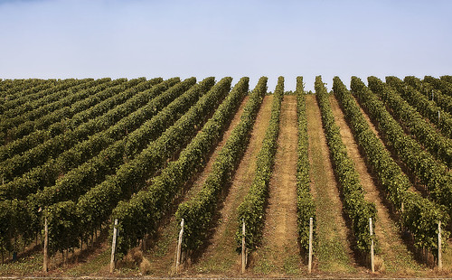
The cycle path disappeared for a while and became a red strip at the side of the road. Vineyards became the dominant scenery, and the sun burned away the mist. The Our river flowed into the Moselle and the valley widened out a little.
I reached the 30 mile mark a few miles short of the French border and stopped for a chicken sandwich and to hang my washing on the back of the bike.
I arrived in Schengen, home to all good shared border agreements, shortly after that. There's probably a good reason for the choice of Schengen for that particular treaty - it stands close to the meeting point of three countries. In the space of a couple of minutes I left Luxembourg, crossed the bridge to Germany and turned the corner into France.
A small model of the Eiffel tower marked my passage into France. The cycle path vanished in the town of Apach and all of a sudden fast lorries and cars were whooshing past my shoulder. Then I remembered the first rule of cycling on N roads in France - don't! I dug out my trusty Michelin atlas pages to plan a nice D-route.
Things got hilly that afternoon. I huffed and puffed my way up a tiny little road, across open farmland and through tiny villages in which stood numerous closed and abandoned cafes. It also happened to get very hot, which was nice but also meant a lot of sweat and a lot of suncream. I reached Bouzonville, a reasonably sized town which didn't appear to have any accommodation but at least had a boulangerie where I was able to buy food and water, and a tabac whose owner directed me to the nearest campsite.
I double checked outside by Googling the place on my phone. I hope that doesn't seem like a rude or mistrustful thing to do. I've been sent on a few wild goose chases before, usually unintentional I'm sure - and whereas locals are normally an excellent source of general information about what's in the area, I don't expect the average person to keep a working and up to date knowledge of campsite opening dates and finer details. However, it looked as if the campsite existed and was open so I headed off in that direction.
An hour later, the sun was getting low in the sky when I reached the campsite, a pretty place beside a lake near the small village of Burtoncourt. It was good to pay single digit prices for camping again!
Distance: 59 miles (361 miles so far) • Day 8 Route • Day 8 Photos


No comments:
Post a Comment